Embed a MyRadar Weather Map
Put a live, animated MyRadar weather map on any web page with one line of HTML, no code required.
Oct 9, 2026 · HTML
Put MyRadar's live, animated weather map on any web page with one line of HTML. There's nothing to install and no code to write: you choose the location, the layers and the look by adding settings to the map's address.
You'll need a MyRadar API key. That's all; the map, the weather data and the base map are hosted for you.
1. Add the map to your page#
Paste this where you want the map, and replace YOUR_KEY with your MyRadar API key:
<iframe
  src="https://embed-map.myradar.dev/?myradar_apikey=YOUR_KEY"
  width="720" height="480" style="border:0" loading="lazy" title="Live weather radar"></iframe>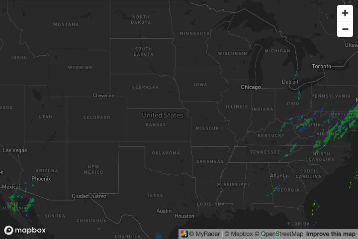
The radar starts playing on its own and loops over the last 100 minutes. To let viewers pause it,
drag back through the loop and read intensities off a color legend, add showTimebar and
showLegend:
?myradar_apikey=YOUR_KEY&showTimebar&showLegend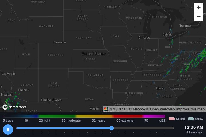
You can also open the same address directly in a browser, for example to link to a full-page map.
2. Point it at your area#
Add center (latitude, longitude) and zoom. Settings are separated by &:
<iframe
src="https://embed-map.myradar.dev/?myradar_apikey=YOUR_KEY¢er=42.2,-93.7&zoom=6.4"
width="720" height="480" style="border:0" loading="lazy" title="Live weather radar"></iframe>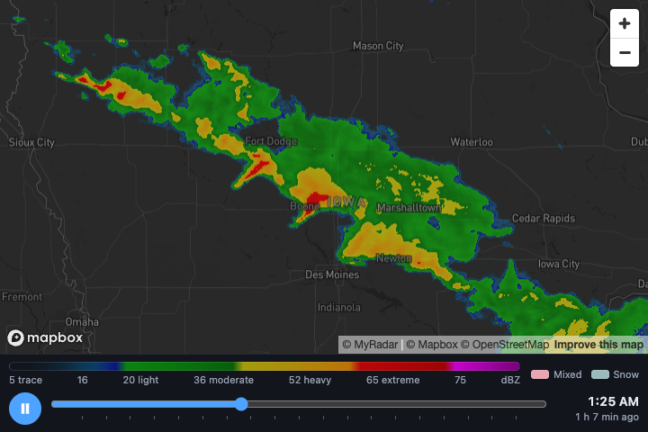
Zoom runs from 1 (the whole world) to 18 (street level). Around 5 shows a few states, around 8 a metro area.
3. Choose what to show#
Only the radar is on unless you turn other layers on:
| Setting | Shows |
|---|---|
showRadar | Animated radar. On by default; showRadar=false turns it off. |
showWarnings | National Weather Service watches, warnings and advisories. |
showLightningStrike | Lightning strikes. |
showLightningFlash | Lightning flashing inside the storms as the radar plays. |
showHurricane | Active hurricanes with their forecast track and cone. |
showWind | Animated wind. |
Add the ones you want, for example warnings and lightning:
?myradar_apikey=YOUR_KEY¢er=42.2,-93.7&zoom=6.2&showWarnings&showLightningStrike&showLightningFlash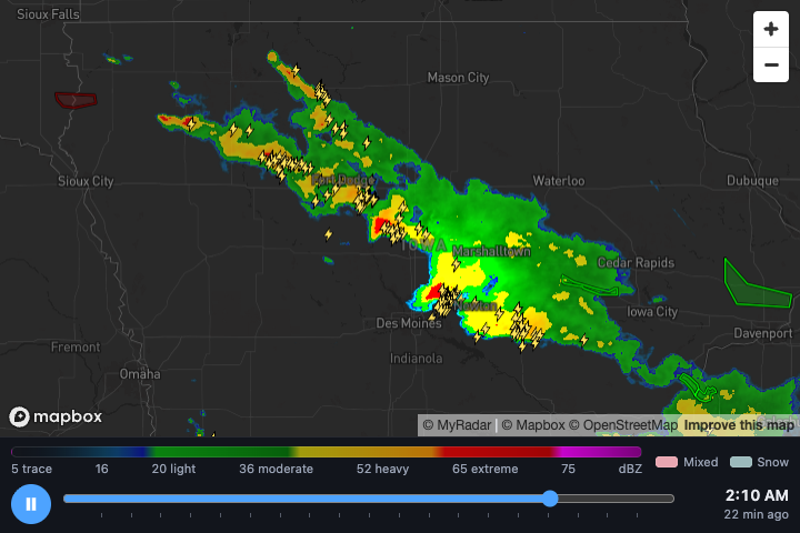
Or hurricanes, on a light map to match a light page with theme=light:
?myradar_apikey=YOUR_KEY¢er=28.8,-86.4&zoom=4.2&showHurricane&theme=light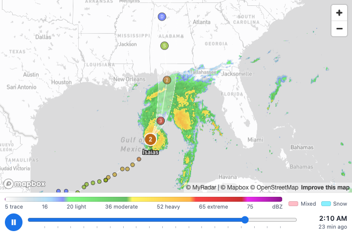
Follow a flight#
Add flight with a flight number (B6778, WN1267) or the callsign the aircraft broadcasts
(JBU778), and the map draws it the way the MyRadar flight tracker does: the track it has flown
(white), its planned route (blue dashes, fainter behind the aircraft), its two airports, and the
aircraft with its altitude and destination. Unless you also set center or zoom, the map frames the whole trip.
The aircraft's position updates every 30 seconds.
?myradar_apikey=YOUR_KEY&flight=B6778&showWarnings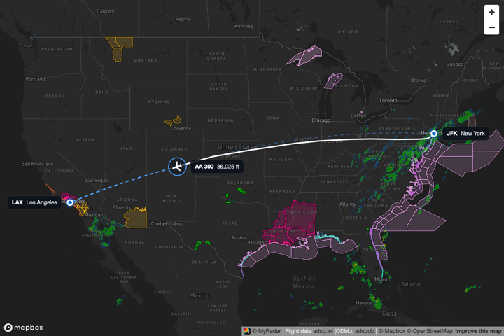
The flight has to be in the air, or on the ground with its transponder on, within range of the volunteer receivers that feed adsb.lol. When no aircraft is broadcasting that flight, or the flight data service doesn't answer, a note across the top of the map says the lookup failed and why, and the weather map works as usual. The planned route is left out when it doesn't match where the aircraft is, which happens when an airline uses one flight number for several legs a day. The airport it took off from is still marked when its track shows the take-off, and the aircraft's label says "destination unknown" rather than guessing. Flight data comes from adsb.lol (ODbL) and adsbdb and is credited on the map.
4. Let visitors choose#
Add showLayers and a switcher appears in the corner so visitors can turn layers on and off
themselves:
?myradar_apikey=YOUR_KEY¢er=42.2,-93.7&zoom=5.8&showLayers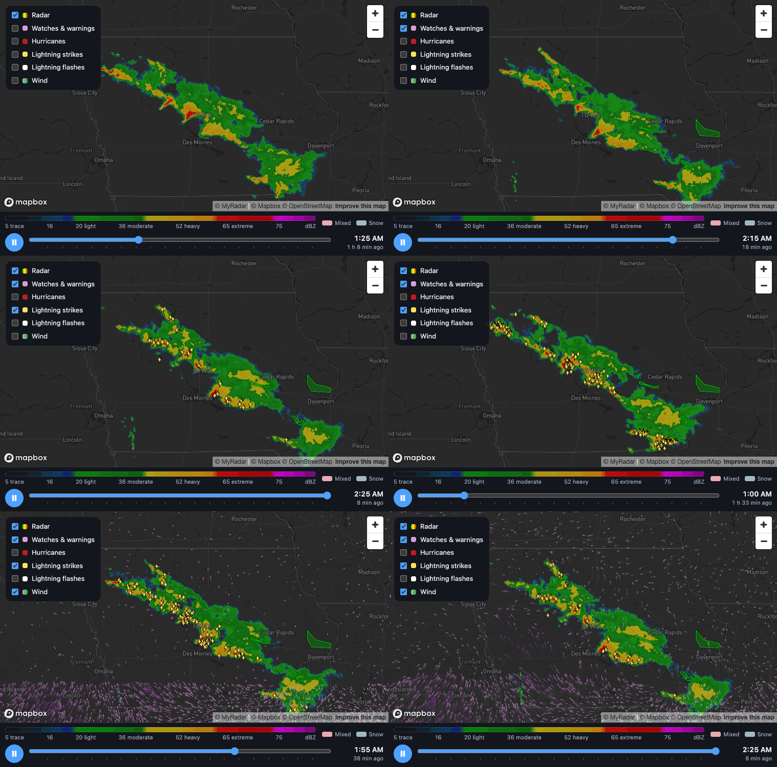
Your show… settings decide what visitors see first. After that their choices win: the map
remembers what each visitor turned on and reopens that way next time. If you later change which
layers your embed shows, everyone starts again from your new settings.
5. Fit the space#
Size the map with the iframe's width and height. To fit it to the page's width at any screen
size, give it a shape instead of a fixed height:
<iframe
src="https://embed-map.myradar.dev/?myradar_apikey=YOUR_KEY¢er=42.2,-93.7&zoom=6"
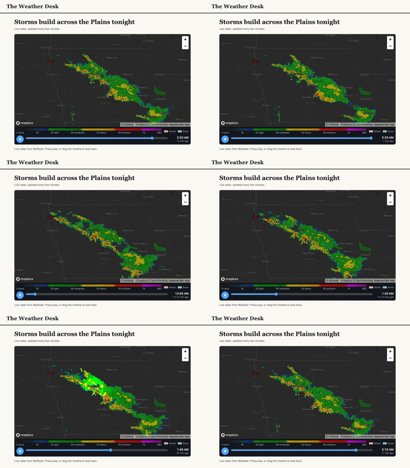
style="width:100%; aspect-ratio:16/10; border:0" loading="lazy" title="Live weather radar"></iframe>That's how the map in the article at the top of this page is embedded.
For small spaces, hide the extras. This makes a 300 × 200 map that only shows the live radar:
?myradar_apikey=YOUR_KEY¢er=42.2,-93.7&zoom=4.6&showZoom=false&interactive=false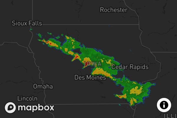
| Setting | Default | |
|---|---|---|
showTimebar | off | Play / pause and the timeline under the map. |
showLegend | off | The radar color legend under the map. |
showZoom | on | The + / − buttons. |
interactive | on | Panning and zooming. Turn it off for a fixed view. |
theme | dark | dark or light. |
Good to know#
-
Scrolling past the map. Inside your page, zooming with the mouse wheel needs Ctrl (⌘ on a Mac), so visitors can scroll past the map without getting stuck in it.
-
Your key is visible. Anyone can read it in your page's source, so use a key issued for this website.
-
If the map shows a message instead of weather, check the key. With no key at all, the map tells you how to add one:
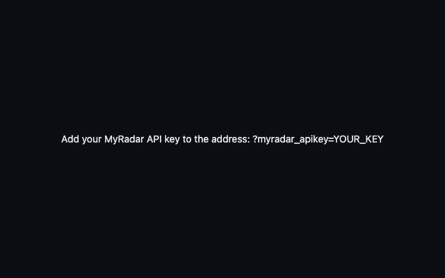
The message shown when the key is missing
All settings#
Settings are case-insensitive, and on / off settings accept true / false, 1 / 0, or just
the name (&showWind means on).
| Setting | Default | |
|---|---|---|
myradar_apikey | required | Your MyRadar API key. |
center | 39,-96 | Latitude and longitude. Or set lat and lon separately. |
zoom | 3.6 | 1 to 18. |
showRadar | on | Animated radar. |
showWarnings | off | Watches, warnings and advisories. |
showLightningStrike | off | Lightning strikes. |
showLightningFlash | off | Lightning flashes in the storms (needs the radar). |
showHurricane | off | Hurricanes. |
showWind | off | Animated wind. |
flight | none | A flight number (B6778) or callsign (JBU778) to draw: track flown, planned route and position. See Follow a flight. |
showLayers | off | Layer switcher for visitors. |
showTimebar | off | Timeline under the map. |
showLegend | off | Radar color legend. |
showZoom | on | Zoom buttons. |
interactive | on | Panning and zooming. |
theme | dark | dark or light. |
product | radar | radar (smooth, high definition), hdRadar (each scan as received) or sdRadar (national composite). |
opacity | 0.65 | Radar opacity, 0 to 1. |
loop | 100 | Minutes of radar history, 10 to 120. |
speed | -0.09 | Playback speed, -0.5 (slower) to 0.5 (faster). The default is a little slower than the MyRadar apps (0). |
autoplay | on | Start playing. Off starts paused on the latest radar. |
width, height | fill the frame | Only for opening the map directly: a size in pixels (600) or px, %, vw, vh. In an iframe, size the iframe instead. |