


 — Real Time Weather Data
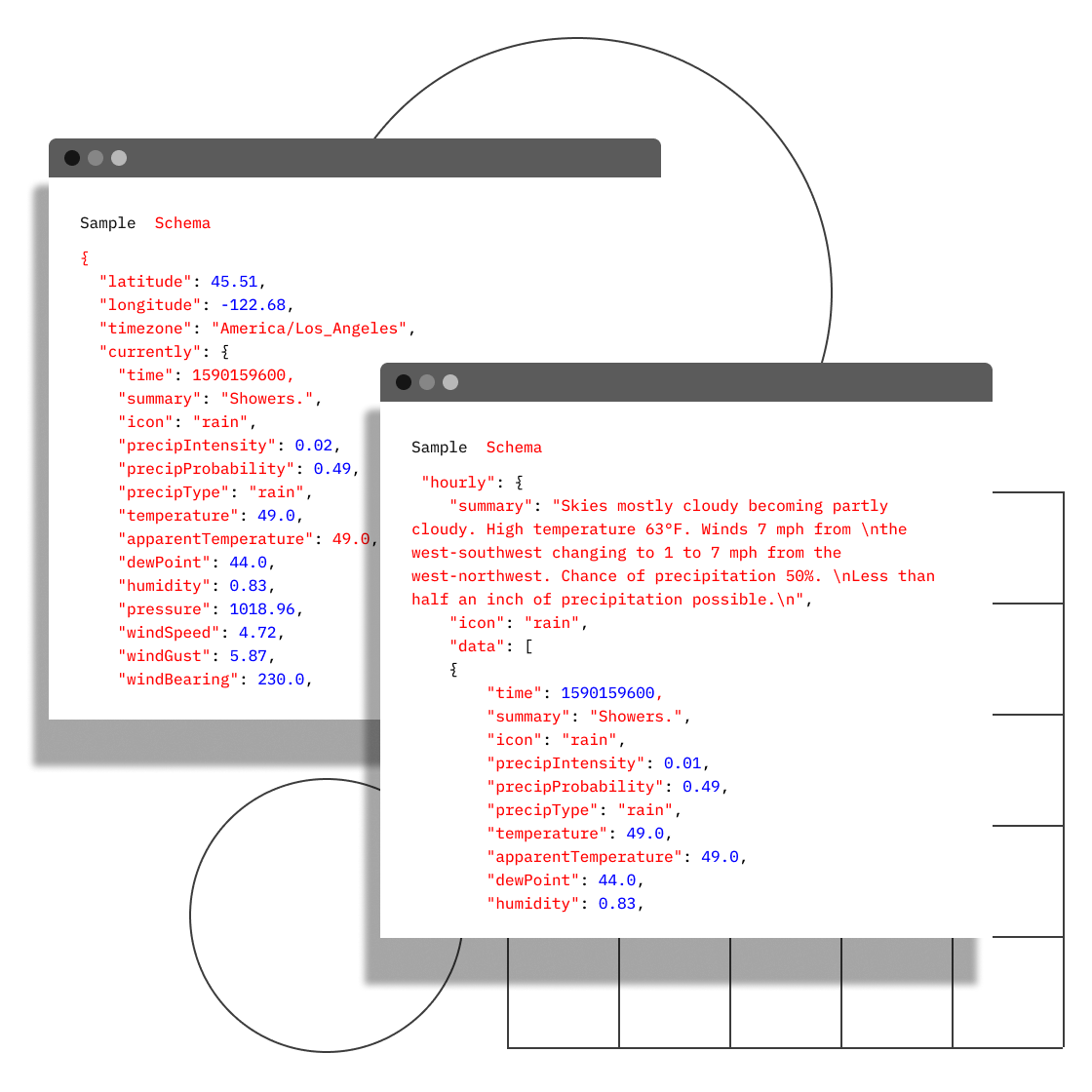

Product
Features
—
Data for alerting, reporting, forecasting, planning
We consume data from the best sources, including our own satellites, to provide you with useful, actionable information.
Our weather radar processing technology is the engine behind several of our successful consumer products. On an average day, we continuously receive about 50 Mb/s of densely compressed radar, temperature and wind data. (Include where our weather data comes from? e.g. Local Data Manager systems (legacy UCAR) from universities) To manage the complexities inherent in providing on-demand radar rendering, we have built a cluster of GPU-heavy machines that allow us to very quickly filter, resample and render hundreds of images per second, in high definition. We use this data to invent new services and augment current services, including real time radar, high definition radar rendering, and patent-pending precipitation nowcasting.

We built our own satellite constellation
We recognized that it was within our area of expertise to make devices that would gather additional data that we could further consume and morph into useful, actionable user data. Enter HORIS, our very own satellite constellation.
HORIS satellites have small form factor and are densely packed with orbital sensors. Orbital sensors are cost-effective and able to produce a literal "top-down" view of conditions on the planet below, so we can provide you with low-cost global coverage. (link to satellite site?)
This is another Subheadline That
Can Go Two Lines.